


iGeology - Interactive geological mapping of the UK.
iGeology is for anyone who wants to explore their local geology, at street-level scale, virtually anywhere in the UK.
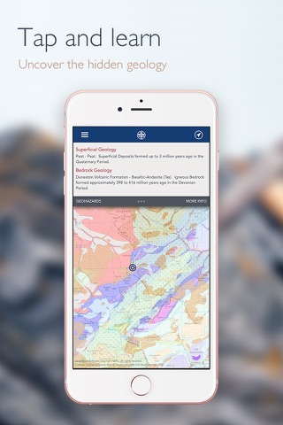
Amateur geologists, walkers and gardeners can look at what’s in their local area, to find out about the rocks at the surface (superficial deposits) or the bedrock beneath.
Search on place names or the postcode where you live, then click on the map and reveal the rocks beneath your feet. iGeology will locate your iPhone or iPad (if GPS is enabled) and zoom to your location.
The maps use the British Geological Survey’s national scale (1:625 000) and ‘Landranger’ scale (1:50 000) geological datasets of the United Kingdom (UK).
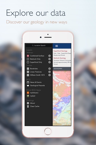
Map coverage
1:50000 dataset covers almost the whole of England, Wales and Scotland. In Version 8 there is now only one map tile with no data on any theme: EW180_Knighton.
Only 1:625 000 scale data is available for Northern Ireland.